EdicitNet at Envirofest again: Cité de la Culture from 11 to 16/06/21

     On the sidelines of the 4th edition of the film festival on the environment Envirofest, taking place from 11 to 16 June 2021, was held the environmental village. This village was the place of exhibition of artists, craftsmen in ecoresponsible products and popularizations of activities of actors impacting the environment in Tunisia.

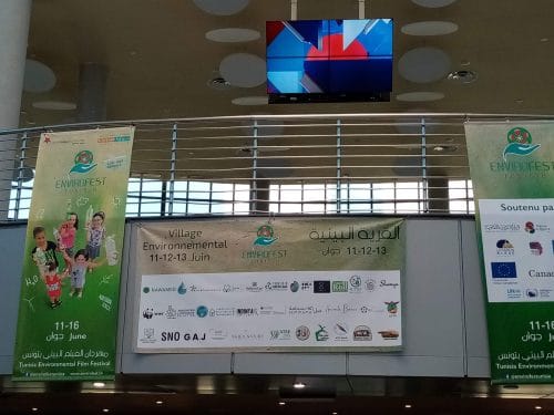
REACT held a stand to present the various projects in which the association is involved. Among which is EdiCitNet. A poster, with the objectives of the project, was exposed as well as the projection of the video clip, about EdiCitNet, realized in November 2020. The originality during this edition was to carry out an action, initiated by REACT in collaboration with ASEST (The Deaf Sports and Educational Academy of Tunis) ASEST (L’Académie Sportive et Educative des Sourds de Tunis), for the inclusion of the deaf and hard of hearing to environmental education.

Thus, groups of deaf and hard-of-hearing children and adults were able to benefit from sign language translation at most of the stands in the environmental village and especially at the REACT stand. The translators explained the objectives of EdiCitNet to this audience in sign language, based on the poster and the video clip, and helped REACT members to animate and make accessible the educational games planned for them. Where, they were led to recognize blindfolded, an array of vegetable and edible plants.


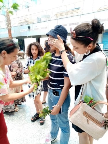
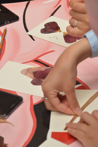
These games were very successful with the deaf and hard of hearing groups because of their playful and enriching aspect. They were then motivated to participate in the second workshop: creation of cards with dried edible plants. Through its participation in events, REACT innovates and integrates playful tools to disseminate the concepts of urban agriculture and edible city.

Key words : Envirofest – urban agriculture – inclusion of the deaf and hard of hearing – environmental
education – EdiCitNet- REACT – Carthage.

Mapping ECS in Sant Feliu de Llobregat

In September, project partner University of Brighton (UoB) started their design research and consultancy with follower city Sant Feliu de Llobregat. Aim of the work is to support the local council in its efforts to integrate ECSs and productive urban landscapes into the spatial and organisational fabric and the everyday life of the city.

The collaboration with the local council, local agroecological cooperative Arran de Terra and Barcelonabased research institute ICRA, all EdiCitNet project partners, is part of the work package 4 food masterplanning overseen by BOKU University Vienna. Within the next year, we aim to co-develop with the local community a series of maps as a tool to identify strategies for urban food planning as well as a method to capture, systematise and visualise those strategies.

Supported by the local city team, we have learned that Sant Feliu de Llobregat and its municipal area are located on the left bank of the Llobregat river valley, where it coincides with the Baix Llobregat Agricultural Park, shared by 14 municipalities. It also borders the Collserola Natural Park, which is an area of natural interest, shared by nine municipalities. Both the Llobregat Agricultural Park and Collserola have significant agricultural activity. This is of great interest as strong, multiple linkages between the urban and rural are a widely recognised advantage when (re)defining the role of food within urban development. At the same time, there exists an increasing number of inner-urban food system and food policy activities in Sant Feliu de Llobregat that we aim to map as part of the 3-stage food opportunity mapping process.

EdiCitNet